
Maps & Data
East Hants uses Geographic Information Systems (GIS) to bring together data and generate maps. The links below are meant to enhance transparency to our residents and explore our Municipality.
Featured Maps

Use this map to browse active planning applications, as well as previously approved or refused applications.
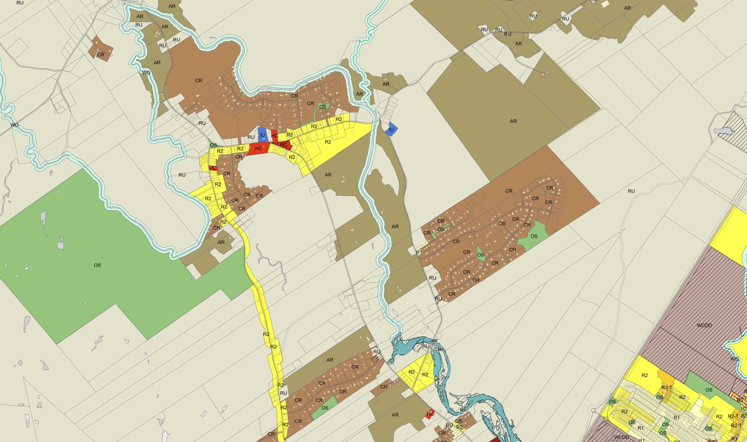
Find out what zone you are in, what planning uses are in place for that area and more!

See who’s responsible for snow clearing in your community and your road’s priority level.

East Hants has a ton of different places to play! The Outdoor Fun map will help you explore trails, playgrounds, water access points and more. You can also filter by inclusive and accessible features.
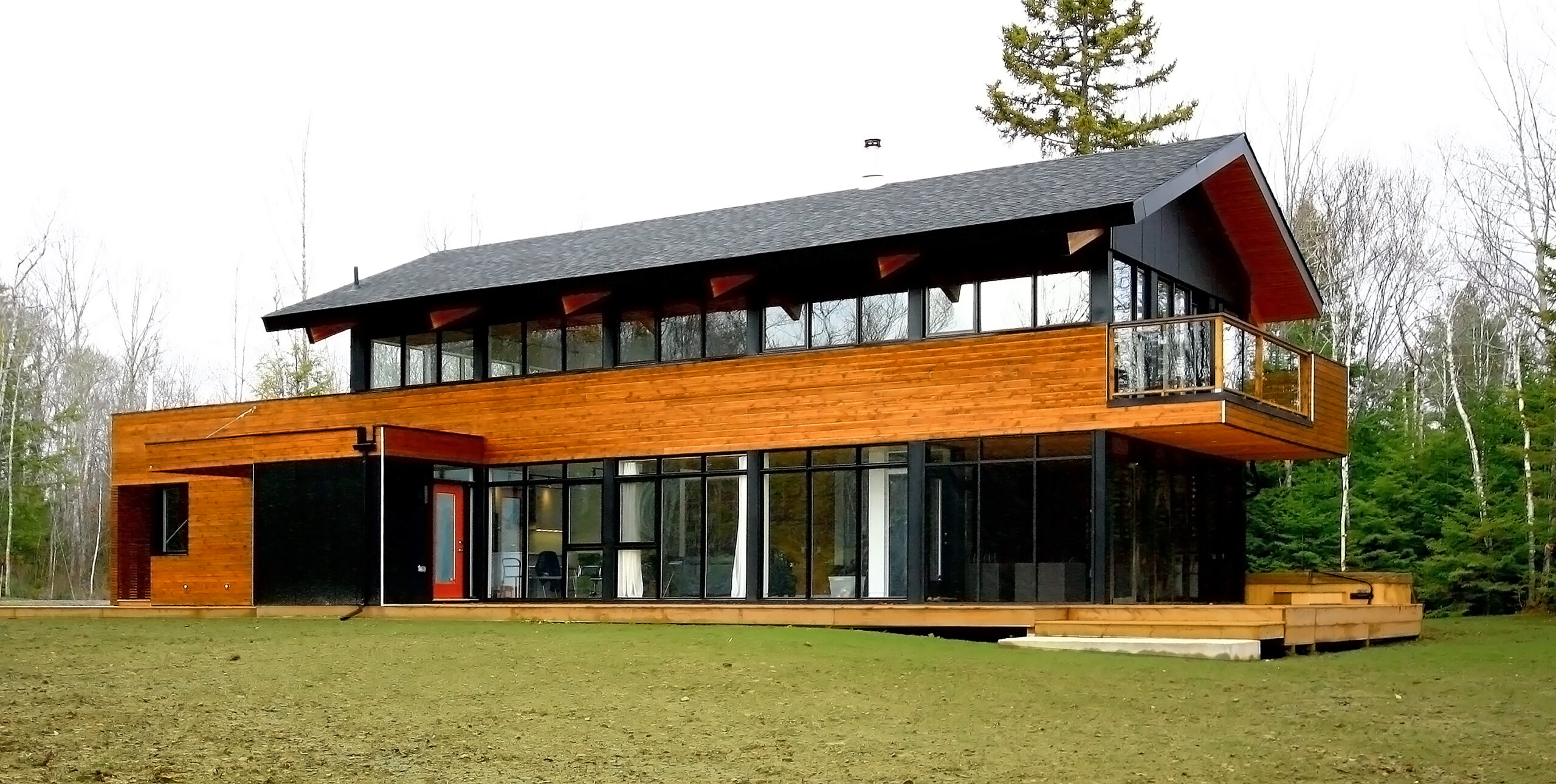
Check out the past winners of the East Hants Design Awards by browsing this map.

Calling all heritage buffs! This map showcases designated heritage properties in East Hants.
East Hants Open Data
Explore recreation, tourism, business and infrastructure data. East Hants provides open data in many different categories as a part of our commitment to open and transparent government.