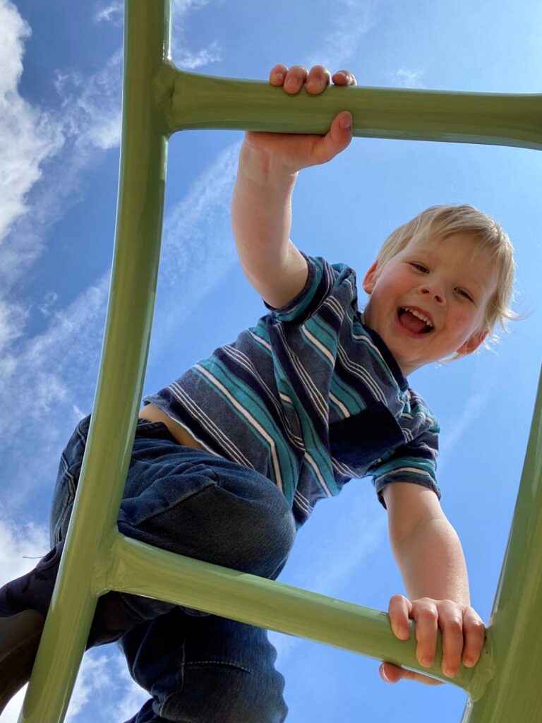
Parks, Playgrounds & Trails
All over East Hants there are outdoor places to play including parks, playgrounds, trails, skateparks and splashpads.
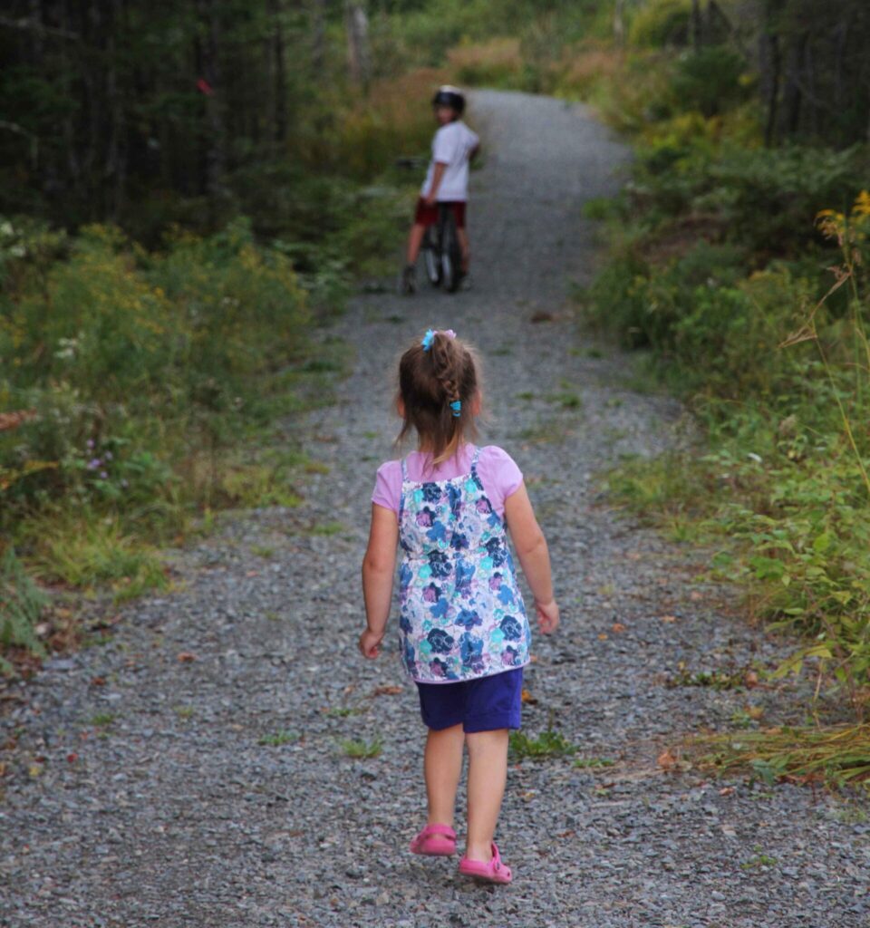
Trails
Bell Park is a historic 55 acre nature park located on Hwy 1 in Mount Uniacke with more than 2 km of signed trails.
The series of walking trails provides an easy hike for pedestrians and pets through a mix of spruce, pine, and various hardwoods. Offering views of West Lake, look offs, and picnic area, Bell Park is definitely a great outdoor destination.
An expanding accessible trail system through woods and Findley Park grounds. Maintained by the Hants North Recreation and Development Association, the trails are open year-round.
The subdivision of Garden Meadows in Belnan is home to the Garden Meadows Trail System. The ever expanding trail offers residents and opportunity to explore their neighborhood while getting to enjoy the outdoors!
Located in the Village of Shubenacadie, this 2.2 km loop provides pedestrians not only beautiful scenery but a sense of tranquility.
The McKeen walkway connects Bakery Lane and Boyd Ave via the Municipal water line easement across the lands of Marie and Leah McKeen, and made available for public use.
The walkway is provided for walkers and non-motorized vehicle use only. Dogs must be on a leash and picked up after.
The Milford Recreation Association Trail is located at 288 Highway 2 in Milford.
This is a 2+ kilometre walking and biking trail system which offers wooded and accessible trails where you can enjoy nature while getting some exercise.
This system is maintained by the Milford Recreation Association and can be enjoyed all year round!
Located at 1143 Enfield Road in Nine Mile River and developed by a volunteer group in partnership with the Municipality of East Hants and the Province of Nova Scotia, the Nine Mile River trail wanders through a variety of forest types and terrain using a combination of developed trail and boardwalks.
At approximately 10 kilometres in total, this multi-use trail offers hours of outdoor adventures. Take in the foliage and enjoy the views of the various trail loops.
Note: Horses not permitted on trail.
A picturesque 350 metre walkway along the river at Sherwood Drive in Enfield.
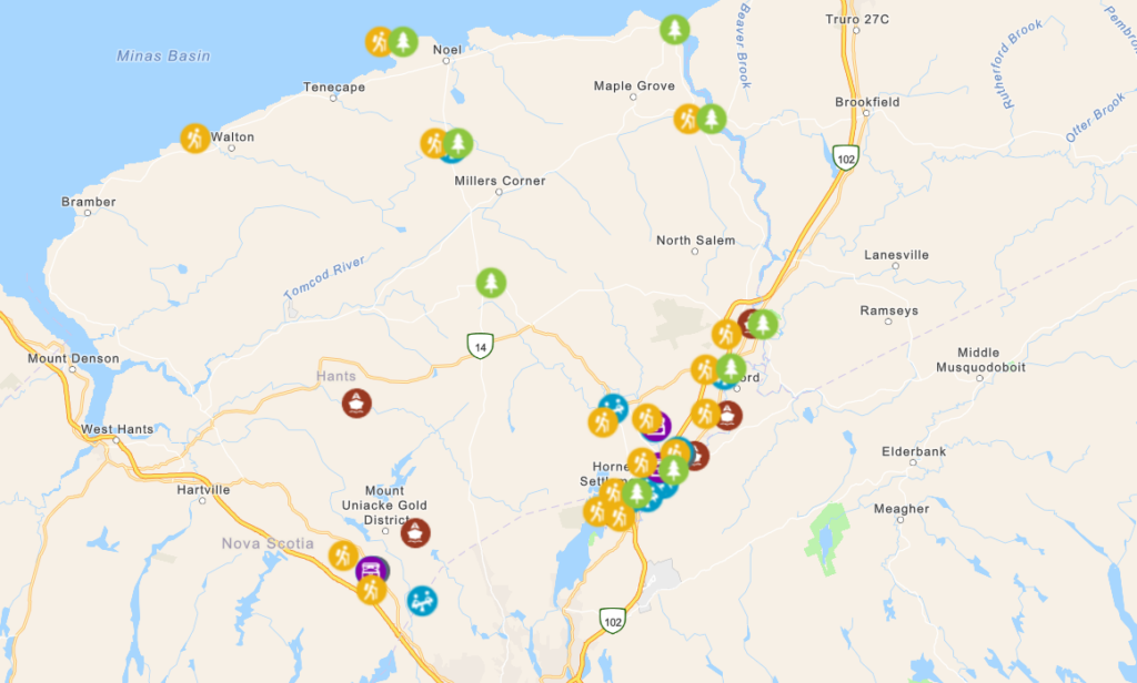
Outdoor Fun Map
Find locations and features of parks, playgrounds, trails and more all across East Hants!
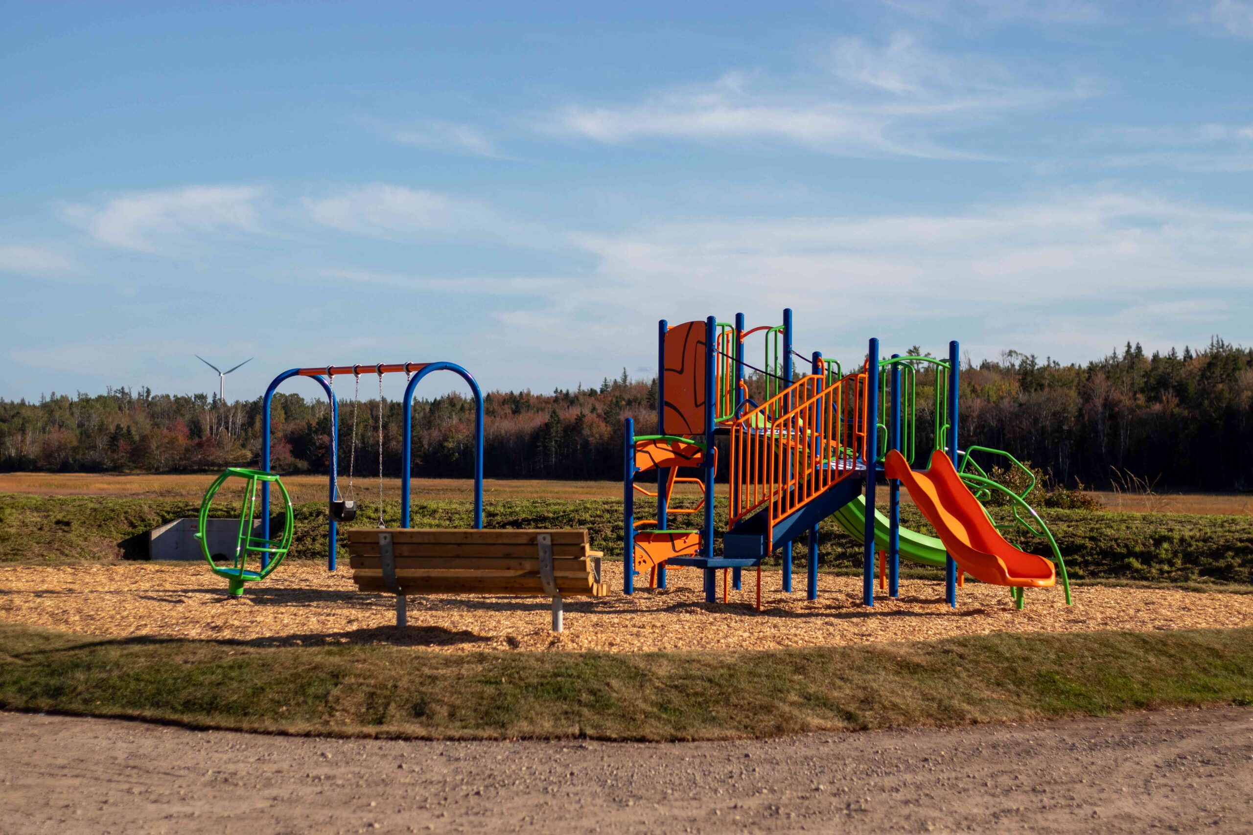
Playgrounds
Neighbourhood playground with swings, slides and climbing equipment.
Neighbourhood playground with swings and picnic tables.
This playground has a unique spinner, slides, climbers and a swing set with a regular and baby seat.
Dot Buchanan Park, run by the Enfield, Elmsdale & District Lions Club, has a partially accessible playground, picnic shelters, trail, pond, soccer fields, beach volleyball court, ball diamond and rugby pitch.
Neighbourhood playground with swings and picnic tables.
Elmwood community park with picnic area, playground, swings, basketball court and open field.
Park with playground, trails, sports facilities, washrooms, splashpad and more. Partially accessible.
Neighbourhood playground with swings and picnic tables.
Neighbourhood playground with swings and picnic tables.
In addition to a playground and skateboard park, MRA grounds feature a gazebo, picnic shelters, recreation grounds, three tennis courts, a pickleball court, a soccer field, a baseball field, a batting cage and wooded, wheelchair accessible walking trail.
Community park containing playground with swings, an accessible swing, accessible merry-go-round and accessible picnic tables.
Playground with picnic table, swings, and basketball court.
A paved, fenced court surface and picnic shelter.
Neighbourhood playground with swings and picnic tables.
Have a picnic, launch your canoe or kayak, or fish from the shoreline.
Accessibility Note:
- The playground has an accessible spinner, partially accessible playground equipment and inclusion swing
- Accessible fishing area
Playground with accessible swing, picnic tables, basketball court and short walking trail.
This playground has a unique spinner, slides, climbers and a swing set with a regular and baby seat.
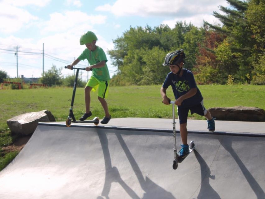
Skate Parks & Splashpads
Located at 1070 Highway 2 in Lantz, this skate park is great for beginners to experienced skateboarders, scooters and BMX riders. It consists of an area of “plaza” or “street” features and a 4′ flow bowl.
Located at 628 Highway 1 in Mount Uniacke, this skate park is great for beginners to pros on skateboards, scooters and BMX’s. This park consists of an assortment of street/plaza obstacles and features, and was built in the shape of a check mark which allows more users on the park at the same time.
- The splash park is NOT a supervised area. Use at your own risk
- The Municipality is not responsible for lost or stolen articles
- We recommend that children under 10 years of age be accompanied by a parent/guardian
- Running, roughness, horseplay and other undue disturbances are strictly prohibited
- Do not climb, hand swing or pull on any of the equipment
- No glass containers or breakable objects allowed
- Infants not toilet trained must wear a swim diaper
- Patrons with a communicable disease or having open sores shall not use the splash pad
- No pets
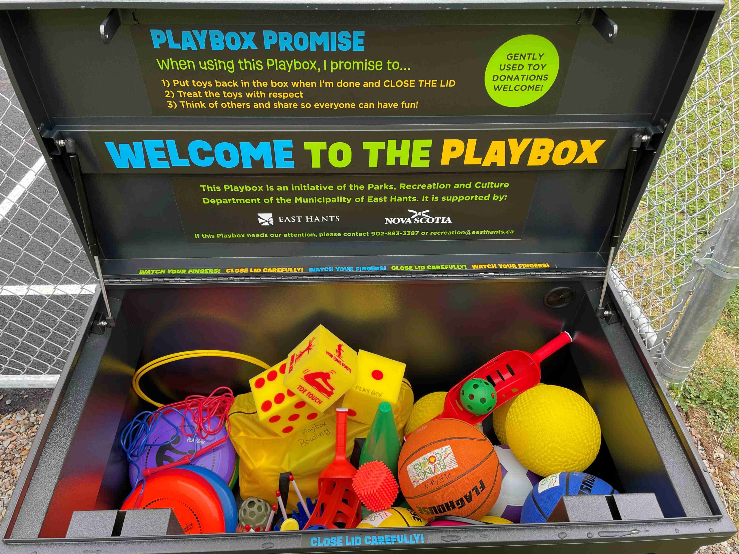
Playboxes
The East Hants Playbox is full of outdoor play equipment for park users to enjoy for FREE. The Playbox initiative is made possible with funding from the Nova Scotia Department of Culture, Communities, Tourism and Heritage.
Where can I find a Playbox?
- Royal Oaks Playground Park – 187 Royal Oaks Way, Belnan
- East Hants Aquatic Centre Splash Pad – 14 Commerce Court, Elmsdale
- Mount Uniacke Memorial Community Park – 670 Highway 1, Mount Uniacke
- Logan Drive Park, Lantz – 40 Towerview Crt, Lantz
- Shubie River Park – 2848 Highway 2, Shubenacadie
- Dawson Dowell Park – Maitland
- Kiln Creek Playground – Lantz
The Playbox Promise
When using the playbox, I promise to…
- Put the equipment back in the box when I’m done and CLOSE THE LID.
- Treat the equipment with respect.
- Think of others and share so everyone can have fun!
- Use the playbox and its contents at your own risk.
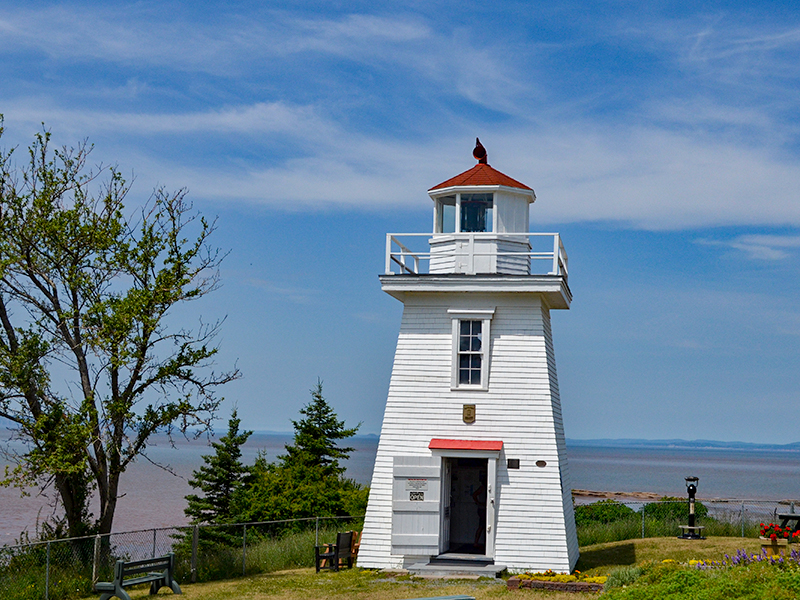
Walton Lighthouse
The Walton Lighthouse is a registered municipal heritage site. The lighthouse and adjacent museum showcase the many historic wonders of East Hants.
Make sure to include a climb up to the top of the lighthouse for a 360 degree, miles long, breathtaking view of the Minas Basin on your day trip to East Hants.
Enjoy an up-close look across the Minas Basin with an onsite telescope or explore a walking trail to a lookout, gazebo and flower gardens.
Gift shop open and tours available from May to October.