
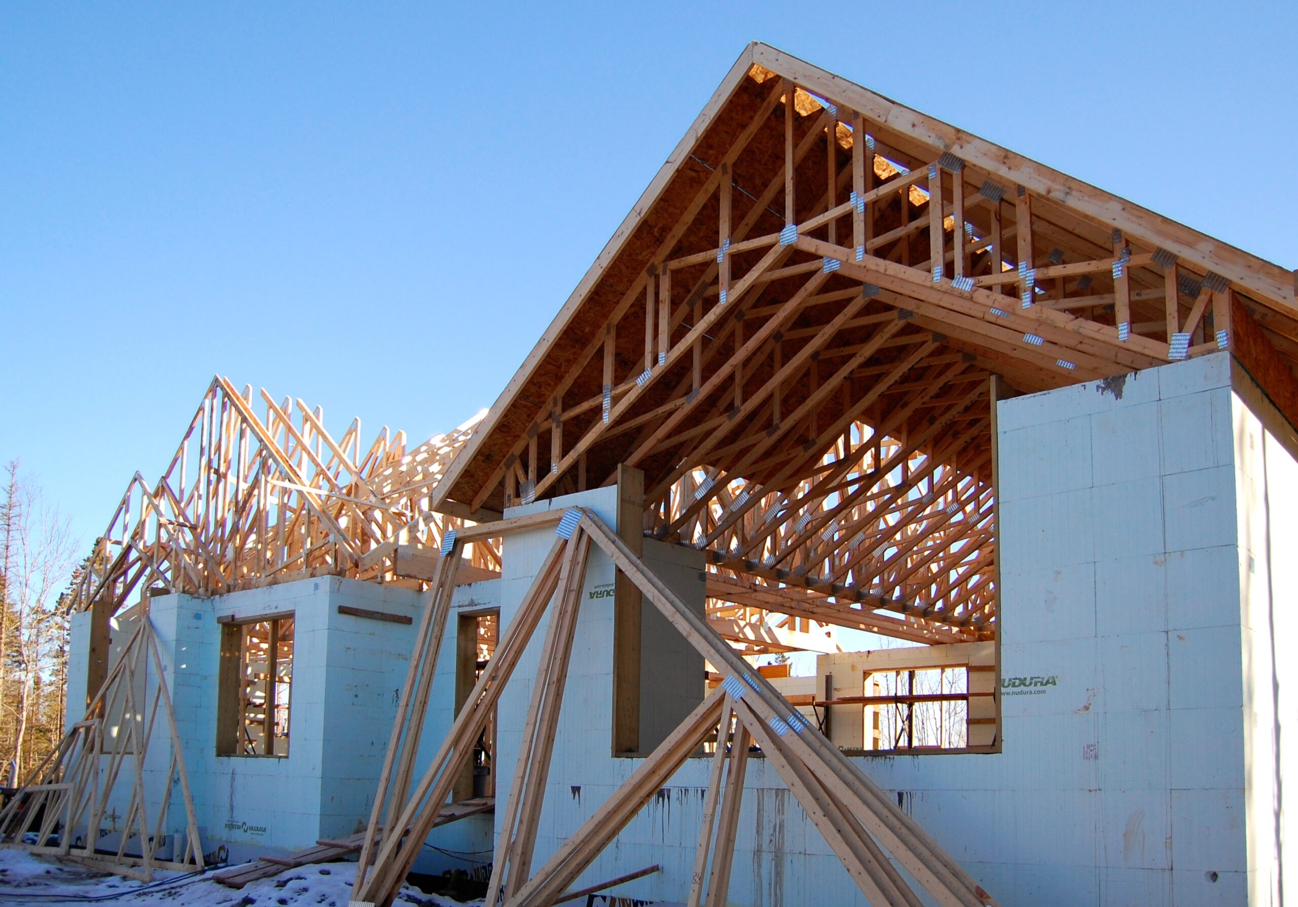
Community Planning
The East Hants Official Community Plan directs how our community grows and develops over time. The entire Municipality of East Hants has comprehensive land use planning. The information below highlights active planning projects and rezoning and development agreements.
2023 Official Community Plan
East Hants’ Community Plan documents are available for download below.
Section B – Citizen Engagement
Section C1 – Growth Management and Infrastructure
Section C2 – Healthy Public Realm
Section C3 – Urban Design & Community Character
Section C5 – Parks, Open Space & Public Facilities
Section C6 – Residential Development
Section C7 – Economic Development
Section C8 – Rural Residential Development
Section C10 – Rural and Agricultural Lands
Section C11 – Tourism & Heritage
Part 6 – Residential Neigbourhood Zones
Part 8 – Separated Commercial Zones
Part 11 – Appendix A Land Use Bylaw Maps
Part 11 – Appendix B Form Based Zone Requirements for the Village Core
Part 11 – Appendix C Site Plan Approval Forms
Part 11 – Appendix D Environmental Study
Part 11 – Appendix E Large Scale Wind Turbines
Active Community Projects
East Hants Council may direct staff to undertake planning-related projects and studies to assist in the future planning and development of the Municipality. These projects could be secondary planning strategies, housing studies, or any other project that will assist with the growth and development of our community.

East Hants Council is working on a Secondary Planning Strategy for the Mount Uniacke and Lakelands areas.
A secondary plan is part of the Official Community Plan that contains policies and land use regulations in an area of the Municipality where major changes are expected and desired.
Information & Resources
In the case of the Mount Uniacke Secondary Planning Strategy, the study will assist the community by identifying large areas of underutilized land that would benefit from increased densification. The Secondary Plan also establishes a detailed planning framework, land uses, identifies transportation improvements and considers issues surrounding on-site services such as potable water and wastewater disposal.
The goal of the Secondary Plan is to ensure that new development will promote and support high-quality design, and establish an appropriate mix of new land uses and new development. It also reinforces the need for a healthy, vibrant, complete, and sustainable community. The Secondary Plan’s objectives are to build on the positive community aspects and to identify areas and methods of densification without hurting the current community character.
The Municipal Housing Strategy project is meant to identify solutions to increase the provision of housing with a focus on affordablity.
In November 2023 Council approved establishing a Municipal Housing Working Group to aid in developing the strategy. The working group will meet monthly for 8-12 months during the strategy development.
Information & Resources
The municipal housing strategy is intended to better understand the housing trends and needs in a municipality.
Municipalities have control over a number of areas beyond zoning that can influence the supply and cost of housing. The housing strategy would highlight those areas and the actions we are proposing to take.
Rezoning and Development Agreements
Planning Applications for rezoning and/or development agreements give the Municipality the opportunity to review development proposals that aren’t permitted as-of-right under the Land Use By-Law. Council makes a decision on the proposal considering: public input, recommendations from Planning Staff and reviewing agencies’ comments.
A development agreement is a legal contract between Council and the property owner. It sets out design requirements and land use regulations that a development proposal must follow. Typically, a development agreement will deal with architectural design, permitted uses, landscaping and site design.
The Municipal Planning Strategy sets out certain types of land uses which must be considered by the development agreement. Uses which have potential to create land use conflicts or large scale and significant development proposals are often considered only by development agreement. The development agreement process ensures the interest and policies of the Municipality are addressed when considering new development proposals.
No development shall be undertaken before the agreement is signed, registered at the Registry of Deeds and necessary permits are obtained from the Municipality.
A property’s zoning determines what type of use is permitted and regulates how a property can be developed. When a land owner wishes to develop a use not permitted by a property’s current zoning or develop the property in a way out of the existing zoning regulations, they may have the option to apply for a zoning change of the property. The rezoning process gives the Municipality the opportunity to review development proposals that are not permitted as-of-right under the Land Use Bylaw.
No development shall be undertaken before the rezoning is finalized and the necessary permits are obtained from the Municipality.
Making the Application
The application process for a development agreement and a rezoning are similar. The applicant must submit a letter of application addressed to:
The Director of Planning and Development
Municipality of East Hants
Box 230 170-15 Commerce Court
Elmsdale, Nova Scotia
B2S 3K5
Letter of Application
The letter of application must provide the following information:
- The name of the property owner(s) requesting the application or, in the event the applicant is not the property owner, a letter of consent from the property owner will be required
- A mailing address and telephone number of the applicant. Please include an email address if you wish to be contacted in that manner
- The location of the property
- A brief description of the purpose of the application outlining any related development proposal
- A cheque fulfilling the application fee and deposit
Learn more about Planning & Development Fees
Site Plans
In some cases, a site or building plan may be required. All plans should be professional quality but do not have to be certified. Plans must be submitted on 11” x 17” paper and must be suitable for reproduction.
Development Agreement Applications
In addition to the information prescribed above, an application for a development agreement may require the following items:
- A site plan, drawn to scale, showing the proposed development indicating the size and dimensions of any new buildings, landscaping, parking areas, the size of parking stalls, etc.
- A PID number (45######) for the property
- A copy of a plan of subdivision
- Renderings, building plans or architectural elevation drawings of any proposed structure
Application Fees
The letter of application must be accompanied by a cheque made payable to the Municipality of East Hants. The fee includes a non-refundable administration fee and a deposit to cover advertising costs, postage for information mailouts and public meeting costs. Any unused portion of the deposit will be refunded and any outstanding balance will be billed to the applicant.
Evaluation
After all required information is received an evaluation of the application is conducted by the Planning and Development Department. Depending on the nature of the development proposal, Staff may request comments from other agencies such as the Municipality’s Infrastructure and Operations Department, Nova Scotia Environment, and the Nova Scotia Department of Transportation and Infrastructure Renewal. Planning Staff also conduct a public participation program to solicit input from the public. Based on this information, Planning Staff evaluate the application to determine if it’s consistent with the East Hants Official Community Plan.
Once an evaluation of the application is complete, a Staff report and recommendation are presented to the Planning Advisory Committee. This committee is responsible for reviewing the application and making a recommendation to Council.
Public Hearing
Rezonings and Development Agreements require approval at an advertised public hearing of Council. It is advisable for the applicant to attend the hearing. At the hearing, Council evaluates the recommendations and information received from Staff, but may decide additional information is required and defer any decision on the application to a later date.
Decision of Council
Following the public hearing, Council will vote on the application. A decision by Council to approve or refuse a Development Agreement or Rezoning application may be subject to appeal to the Nova Scotia Utility and Review Board. Within 14 days of publication of a notice of approval or of the applicant receiving notice of Council’s refusal, the decision of Council may be appealed. A decision to approve or refuse an application is not final until the appeal period expires and all appeals are exhausted.
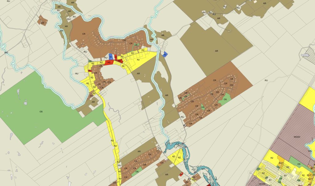
Zoning Look Up Map
Find out what zone your community is in and what planning uses are in place for that area.
Lakeshore Development
It is the responsibility of every East Hants lake front property owner to help keep our lakes healthy. Our lakes have long been enjoyed for their natural beauty and recreational opportunities. In order for future generations of East Hants residents to continue to enjoy our lakes, the riparian areas around the lakes need to be protected.
East Hants has regulations that control development along the riparian areas of our lakes. The purpose of these regulations is to protect and enhance the lakeshores through the use of setbacks and restrictions on the removal of vegetation.
Lakeshore Land Use Regulations
The following regulations are applicable to lakeshore properties in the comprehensively zoned area of East Hants:
A 30 m setback shall be required from the high water mark of all lakes and the nearest wall of any permanent structure. Where the 30 m setback cannot be met for existing structures and for existing undersized lots, due to topography, or the placement of an on-site disposal system, the setback may be reduced to no less than 15 m where all other requirements under the Land Use Bylaw are met. No significant alteration of topography, being the cutting or filling of more than 10% of the land area within the setback or 93 m2 of area within the setback.
Natural vegetation within 10 m from the normal high water mark of any lake shoreline is to remain undisturbed except to allow for the construction of docks and boathouses. In addition, up to 35% of trees and underbrush may be removed to enable a filtered view of the lake.
One boathouse per property up to 56 m2 in floor area is permitted for the storage of boats, watercraft like canoes and kayaks, and associated marine accessories and equipment.